Saturday, October 6, 2012

Who Was Bruce of Potentilla bruceae?


Carola Josephine Austin was who was born in 1865 at Slate Creek, near Quincy, Plumas County.  Her mother, Rebecca Merritt Austin, was a prolific early California botanist.    Barneby (N. American Astragalus p. 1050, 1964) gives her name as Carola Josephine but the Mansfield record (below) as simply Josephine.  .  According to "History of Butte County, Cal.," by George C. Mansfield, Pages 1157-1158, Historic Record Co, Los Angeles, CA, 1918 (transcribed by Sharon Walford Yost), “She taught school until her marriage in 1884.  She devote much time to gathering specimens for the Smithsonian Institution at Washington, D. C., collecting and mounting seventeen hundred specimens in one year, but finally discontinued the work on account of her health.  In the CCH, there are 105 accessions at CAS/DS, 61 at UC/JEPS, 383 at RSA/POM and a few elsewhere.

Mansfield:  “After her marriage to Charles Bruce, they were engaged in ranching for a time at Chico, and then moved to Goose Lake Valley, Modoc County, where they continued ranching for five years.  Meantime they had purchased one hundred sixty acres near Lakeview, which he later sold, and then returned to Chico, where again they resumed ranching.  In 1906, they bought a place of ten acres on Eighth Avenue, and had other tree crop orchards in the region.”   

Barneby (1964) gives her date of death in 1931.

IPNI records the following basionyms established in her honor, all with the epithet ‘Bruceae’:
Arnica bruceae Rydb. -- N. Amer. Fl. 34(4): 347. 1927 [27 Jun 1927]
Crepis bruceae Babc. -- Univ. Calif. Publ. Bot. xxii. 401 (1947).
Arabis bruceae M.E.Jones -- Contr. W. Bot. 14: 37. 1912 [29 Jun 1912] (IK)
Astragalus tener var. bruceae M.E.Jones – Rev. Astragalus 268. 1923.
Potentilla bruceae Rydb. -- N. Amer. Fl. xxii. 342 (1908).
Collinsia bruceae M. E. Jones – Contr. W. Bot. 12: 69–70. 1908.

Only the Potentilla survives as a currently treated taxon.


The CCH records begin in April 1887 and are mostly from northern California, and the last is Astragalus bolanderi, at Alta Meadows in 1905.  

Thursday, July 26, 2012

Hydrophytic vegetation of the San Joaquin Delta


With the revival of quasi-dormant debate over the Peripheral Canal/Tunnel,  I point out our poor understanding of Delta flora and vegetation in relation to salinity gradients.  Marsh salinity in the Delta region is suspected to have undergone a strong, directional increase associated with anthropogenic hydrologic modification.  I have not yet found a comprehensive analysis of existing vegetation salinity gradient relationships, and consequently wonder if any such study has been undertaken.  Predicting future vectors of marsh ecosystem change, and any but feeble hope for restoration, needs to account for pre-settlement flora and vegetation conditions in the Delta.

On July 17, 1896 Willis Jepson collected yellow pond lily (Nuphar polysepala) at Stockton.  Nuphar polysepala is a scattered, important member of the hydrophytic flora of Sierran lakes, mainly at about 7000 ft.  Nuphar does occur at low elevations, such as in Marin County, and other coastal lakes.  The occurrence of N. polysepala in the deltaic Great Valley is significant because this taxon is a indicator of water salinity: it is salt intolerant (1). 

Nuphar polysepala was still extant near Stockton at least until the early 1970s.  In the mid-1960s, it was still present in Pixley Slough.  In the 1970s, it was present near Snodgrass Slough near Locke, although this latter site was not recorded by Bowcutt (2).   Very probably, if salt water intrusion has taken its toll on the Delta hydrophyte flora, Nuphar would now be extirpated.  Is it? 

Several other hydrophytes are known from >60-100 yr old historical records in the Delta: Carex comosa near Holt in 1928, Meneyanthes trifoliata (3), Potamogeton nodosus in 1928, P. zosteriformis in 1949 etc etc.  Lycopus americanus, another non-saline hydrophyte, is apparently still present as of 2002. 

These non-saline hydrophytes are indicators of delta water quality and their local distribution, and their placement in a data-based gradient analysis of Delta marsh vegetation is needed.  

I poist that saline intolerant hydrophytes have been eliminated from much of the Delta region associated with the inland intrusion of brackish or saline waters.  If these non-halophytic halophytes persist today, their communities become a model for restoration.  Where might this persistent, original hydrophytic vegetation remnants be ?

1.  Padget, D. et al. 1999. American Journal of Botany 86(9): 1316–1324.
2.  Bowcutt, F.  1996. Madrono Vol. 43, no. 3, pp. 417-431.
3.  Mason, H.  1957. Flora of the Marshes of California. UC Press

Sunday, July 22, 2012

Northern distributional limit of Juniperus californica


Over expansive portions of North America, juniper dominated vegetation is afforded ‘formation’ status: that is, a dominant, zonal ecosystem characterized by a single species (dominant in biomass and of trophic cascades), extensive, climatically-correlated vegetation type on a continent-wide scale.  In California, a Juniperus californica community has not been recognized at the higher-syntaxon level: in southerly California, Thorne (1) did not distinguish a Juniperus californica vegetation type where it is most abundant.  Certainly at lower syntaxonomic levels (associations), J. california communities are of ecological interest. California juniper rarely forms extensive stands in the northerly part of its geographic range.

The geographic range of J. californica has been little discussed in classical conifer synchorological literature: Jim Griffin and Bill Critchfield did not map Junperus california (2) probably because these foresters considered it to be 'not a tree'.  Conifer distribution maps offered up by Little (3), using his characteristic method whereby a radius envelope was drawn encircling each known site, shows the range of J. californica becoming more discontinuous  northward in California.  The range map in Adams (4) is generalized.

I will leave aside the fact that southerly Junipers related to J. californica should probably be afforded taxonomic segregation (perhaps as subspecies):  J. cedrociana on Cedros Island;  J. ‘californica’ on Guadalupe Island, which is considered extirpated; might be distinct, given the density of unique endemics in that flora.  Others in far south Baja?

Of considerable interest is the single specimen attributed to J. californica from the Klamath River canyon, Siskiyou County (SD51279), fully 100 miles north of Ash Creek.  What species is this?  A Juniper plexus-nexus might be indicated in the Klamath-Siskiyou ‘knot’ which perhaps still has some untying to do: Juniperus californica var. klamathensis L.F. Henderson, described from near Mt. Ashland, and considered a synonym of J. occidentalis (4), is at the far westerly extent of that arid, cold-interior tree.  Also of note is a disjunct outlier also being called J. occidentalis (2) in Trinity County.  All of these, again, indicate a Klamath-knot that merits study to untie; Vasek (6) found some of these westerly outliers to be chemically distinct.

Sudworth (5) reported J. occidentalis from the Canyon Creek Lakes watershed in the Trinity Alps: Griffin & Critchfield (2) guessed this report to be Juniperus communis (of Sect. Juniperus):  this report needs field survey, as the Canyon Creek watershed obviously has its own entangled ‘Klamath knot” in the guise of Bochera serpenticola, Sedum paradisum and other narrow endemics which grow there.

Northern Limit at Ash Creek
The northerly distributional limit of J. californica is at the very head of the Sacramento Valley,  specifically at Ash Creek, east of Anderson, which is tributary to the Sacramento River just north of the Tehama County line.  The colony of J. californica is scattered within a foothill savannah matrix of Quercus douglasii and Pinus sabiniana on very shallow, stony, volcanic-derived ‘soils’.   Specimens attributed to another Ash Creek (specifically CAS349187) are incorrectly mapped.  Other far N specimens are mis-labeled (CAS515186), these are J. occidentalis.

The Juniperus californica stand can be seen along the county road (Ash Creek Road) for several miles beginning at the low hills that begin just east of the Sacramento River crossing at Balls Ferry.   The site has not burned in recent times, and many trees are large ‘bushes’ – that is, about 3-4 meters tall and multi-trunked. 

References
1. Thorne, R.F.  1976.  pp. 1-31 in Vegetation of Southern California.  Calif. Native Plant Soc.
2.  Griffin, J.R. & W.B. Critchfield. 1976 (supplement).  USDA Forest Service Res. Paper PSW-82
3.  Little, E.L.  1971.  Atlas of United States Trees. Vol. 1. USDA Forest Service Misc. Pub. 1146
4.  Adams, R.P.  2011.  Junipers of the World: the genus Juniperus.  3rd ed.
5.  Sudworth, G.B.  1901.  Forest trees of the Pacific slope.  USDA.
6.  Vasek, F.C.  1966.  The distribution and taxonomy of three western Junipers.  Brittonia 18:350-372.

Saturday, July 7, 2012

The biogeographically correct eastern border of California's Klamath bioregion


In formulating the now well known Jepson bioregions for California, Jim Hickman made one significant error: he mis-mapped the geographic setting that differentiates the Klamath Ranges (KR) region from the Cascade Ranges (CaR) region.  Hickman’s boundary concept was correctly formulated: the Cascade region he characterized as “this volcanic region..” which contrasted with the Klamath Range region geologically,  which is also correlated with strong biogeographic pattern (along an aridity gradient from toward the interior).  However, in the 1989 edition (Hickman 1989), the map depicts the border that, in the color map and text in the 1993 Jepson Manual (Hickamn 1993), is “...more or less along of Interstate 5”. 

This border is geologically and biogeographically wrong.

Both geologically and biogeographically, the Klamath Ranges region includes about 250,000 acres of non-volcanic mountainous terrain comprising the McCloud arm, Squaw Creek arm, Pit River arm of Shasta reservoir, including the highest peaks in the reigon Grizzly Peak (6252 ft) and Bald Mountain (5536 ft), a region of metamorphic rocks.  The vegetation of the region has more in common with the Klamath Ranges than the Cascade Ranges, being forests largely dominated by Douglas-fir.  The region in question is home to two endemics I have described: Shasta boneset (Agartina shastensis) and Shasta Snow-wreath (Neviusia cliftonii), both with high fidelity for calcareous, not volcanic rocks.

The first figure shows the proposed, corrected border between the KR and CaR regions (red line) imposed on the map that appears in the inside front cover of both editions of the Jepson Manual.

Essentially, the border I suggest is exactly coincident with the extent of the Eastern Klamath terrane (Irwin 1994), which to the east is bordered by Quaternary and Tertiary volcanic rocks of the true Cascade ranges (yellow eastern border of the second figure).


References:

Hickman, J.C. 1989.  Introduction to the Jepson Manual.  Jepson Herbarium, University of California, Berkeley.

Hickman, J.C.  [Ed.].  1993.  The Jepson Manual, Higher Plants of California.  University of California Press.

Irwin, W.  1994.  Geologic Map of the Klamath Mountains, California and Oregon.  USGS Map I-2148.


Thursday, June 28, 2012


Poison Oak (Toxicodendron diversilobum) is a fighter.  This post is short: and has a simple point.  Cant get rid of it at my house.

My house in coastal central CA [40 inches mean ppt, frost rare] had an undeveloped, adjacent lot when, in 1986, I moved in.  Hack, Hack, Hack again later, clearing trees, grubbing stumps, planting a garden later, one would presume that any plant I had overtly targeted for eradication would now be toast, 26 yr afterwards. 

Despite grubbing, despite Roundup, T. diversilobum continues to re-appear here and there.  The indication I take away is that the rhizome system is very much like that of a vagile invader such as Convolvulus arvensis; in which, when fragmented, tiny little fragments maintain, then gain, and continue demographic existence, as if awaiting a relaxation of control.  In my neighborhood, T. diversilobum assumed the two known growth forms: 1) lianas which grow via attachment roots (cf. Hedera, Araliaceae) to 100 feet in the crown of old-growth Sequoia sempervirens, or 2) bushy, highly branched ‘shrubs’.  The overall indication I intend with this post is that the phenotypic plasticity of  T. diversilobum seems to be under genetic control.   General purpose genotype?

Merits study with molecular methods.

Sunday, June 17, 2012

Marble in Plumas County


Substrate controlled endemism IS the California flora: in one word; serpentine!  A secondary “hot spot” in our flora is limestone and/or marble.  Be it a big white flowered shrub, Neviusia, or a Heterotheca monarchensis, calcareous substrata are invariably worthy of exploration for new novelties or new records. 

In the Sierra, limestone and or marble occurs as isolated, small rock masses, often these do not get mapped at the 1:250,000 scale of the state geologic maps.  A systematic survey of these 'islands' is needed.

A calcareous site worthy of visitation is Marble Cone, in the Middle Fork Feather River.  At least based on CCH specimen records with coordinates, no collector has been in the vicinity.  Access seems, from the topographic maps at least, is uncertain, but 4WD roads get within about a mile upcanyon, or a trail about the same distance downcanyon. 

Someone, go yonder.

Tuesday, June 12, 2012

Lomatium ravenii, Hunzinger Flat, Lassen County, California?


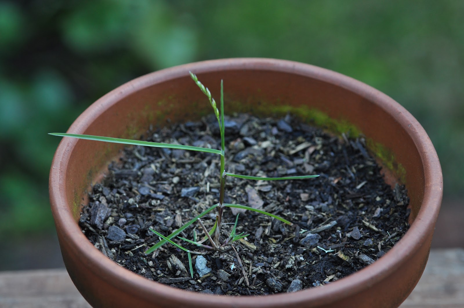
NDDB EO#32 Lomatium ravenii at this site was reported in first in 2003, without citation of a voucher specimen, and without any subsequent revisits.  On June 6, 2012 I visited the site, and having also visited the type locality for L. ravenii (1 mile S of Ravendale) and nearby sites, am uncertain of the taxon of Lomatium present at NDDB EO#32 (1/4 mile N Hunzinger Flat, Lassen County, 41.09199 - 120.78617)

Lomatium ravenii was described by Mathias & Constance (1959).  It was treated as distinct by Constance (1993).  Cronquist (1997), however, did not recognize L. ravenii: rather, he submerged it within a wholesale variable and geographically widespread L. nevadense (with a geographic range over most of the northern Great Basin).

At the type locality of L. ravenii, and at nearby reported sites on the Madeline Plains, Lassen County, plants answering to L. ravenii have leaves that are subtly but distinctly different from the plants at  NDDB EO#32, being more finely dissected [that is, upon morphometric analysis, cf.  Carlson et al. 2011, would a) show a greater bifurcation ratio, and b) would have linear, fewer lobed terminal leaflet segments as compared to topotype material of L. ravenii).  Published manuals use flower color to distinguish taxa of Lomatium, and because these plants flower very early (often before regional road networks are passable and snowfree) flower color is often not evident on herbarium specimens.  The plants at NDDB EO#32 did not have purple flowers, but because flower color fades quickly in the yellow flowered taxa, such that spent flowers of both yellow and white flowered taxa appear similar in senescence, flower color of NDDB EO#32 was not evident on my visit. (I will also comment here than central Nevada material at NY attributed does not match the type of L. ravenii, and is probably undescribed)

Taxonomy of Great Basin Lomatium allied to L. nevadense is not resolved.  Lomatium ravenii has been attributed to a range across most of the central Great Basin (Constance & Weatherwax 2012).  However, plants allied to this group from eastern Oregon have been shown to be a distinct species, L. bentonitum (Carlson et al. 2011).

My specimen of NDDB EO#32 is more similar in leaf morphology to L. foeniculaceum var. macdougalii, as treated in TJM2 (Constance & Weatherwax 2012), at least compared to material attributed to this taxon from near Alturas, and material from central Oregon.  There is a unprocessed record for L. ravenii for the Lane Reservoir quadrangle, and if a second site is known, would be important to voucher if appropriate.  Notable in this regard that many reported occurrences of L. foeniculaceum var. macdougalii and L. ravenii from Modoc and Lassen counties are not vouchered.

A salient habitat difference pertaining to site occupancy for L. foeniculaceum var. macdougalii versus L. ravenii is related to substrate.  Lomatium ravenii, at least the type population, and other populations on the Madeline Plains, occur on fine, clay and silt, subalkaline lacustrine and aeolian deposits that form deep soils on sites that are seasonally flooded in the exceptional, infrequent wet year (see photo on Calphotos).  By contrast, L. foeniculaceum var. macdougalii occurs on tehpra deposits (material that falls out of the air associated with explosive vulcanism events).  At NDDB EO#32 the deposit is a volcaniclastic tephra that was entrained within a mudflow,  which subsequently set.  The parent material at the site has weathered sufficiently to have a high clay component in the soil.  However, the site is not subalkaline, but rather the soils are slightly acidic.   By contrast, the soil pH at sites I visited for L. ravenii ranged from 7.5 to 8.1 .  This habitat contract is suggestive that the plants at EO#32 are L. foeniculaceum var. macdougalii rather than L. ravenii.

It should be noted here that the revised Jepson Manual treatment attributed to Lincoln Constance was not extensively changed from his 1993 treatment (since he was not active by 1999 and died in 2001).  That fact posits the problem that some California endemic taxa would benefit from additional study, which, along with the recent description of other novel, narrowly endemic, rare taxa of Lomatium from the arid western U.S. (Helliwell 2010, Darrach & Wagner 2011, Darrach et al. 2011),  suggests further study of the entire genus is suggested, and that determination of the distribution and occurrence of rare taxon of Lomatium in northeastern California is far from resolved (cf. Soltis & Novak 1997, Gitzendanner & Soltis 2001).


Constance, L. and M. Weatherwax. 2012.  Apiaceae, in B.G. Baldwin et al. [Eds.], The Jepson Manual, Vascular Plants of California .  Univ. California Press.

Constance, L. 1993.  Apiaceae, in J.C. Hickman [Ed.], The Jepson Manual, Vascular Plants of California .  Univ. California Press.

Cronquist, A.  1997.  Lomatium, pp. 394-420 in A. Cronquist, N.H. Holmgren & P.K. Holmgren.  Intermountain Flora Vol. 3A.  New York Botanical Garden.

Carlson, K.M., D.H. Mansfield & J.F. Smith.  2011.  A new species in the Lomatium foeniculaceum (Apiaceae) clade revealed through combined morphometric and phylogenetic analysis.  Systematic Botany 36(2):495-507.

Darrach, M., K.K. Theib, B.L. Wilson, R.E. Brainerd and N. Otting.  2011.  Lomatium tamanitchii (Apiaceae), a new species from Oregon and Washington state, U.S.A.  Madrono Vol. 58.

Darrach, M. & D.H. Wagner. 2011.  Lomatium pastoralis (Apiaceae), a new narrow endemic species from Northeast Oregon.  J. Bot. Research Institute Texas 5(2):427-435.

Gitzendanner, M.A. and P.S. Soltis.  2001.  Genetic variation in rare and widespread Lomatium species (Apiaceae): A comparison of AFLP and SSCP data.  Edinburgh Journal of Botany 58:347-356.

Mathias, M.E. & L. Constance.  1959.  New North American Umbelliferae – III.  Bull. Torrey Botanical Club 86:374-382.

Soltis, P.S. & S.J. Novak.  1997.  Polyphylly of the tuberout Lomatiums (Apiaceae): cpDNA evidence for morphological convergence.  Systematic Botany 22:99-112.

Saturday, May 26, 2012

Fimbriate desert-parsley (Lomatium foeniculaceum var. fimbriatum) near Alturas, Modoc County?


In California, Lomatium foeniculaceum is represented by 3 of the five races treated by Theobold (Brittonia 18:1-18. 1966) and Holmgren (Intermountain Flora Vol. 3A. 1997).  Records attribute all of the Modoc Plateau occurrences as Lomatium foeniculaceum var. macdougalii, CNPS List 2.2, a rare plant.

Holmgren and TJM2 keys respectively distinguish var. fimbriatum on the basis of “petals ciliolate margined (unique in the species)” and “petal margin minutely ciliate”.


Plants of the population of Lomatium foeniculaceum on the southerly outskirts of Alturas were in flower this year on May 16th.  Plants in this occurrence have petals that are NOT glabrous on the surface nor on the petal margin, making them similar to the circumscription of var. fimbriatum.  The EO#10 plants do not have the very regular, minutely ciliate petal margins with glabrous petal faces illustrated in Intermountain Flora Vol. 3A p. 407.  Rather, they are have irregular, dense trichomes over both the petal surface and irregularly along the petal margin.

Many of the Modoc County locations of Lomatium foeniculaceum lack a voucher specimen, making determination of the petal glabrous/pubescent feature uncertain.   Lomatium foeniculaceum var. fimbriatum was described from a White Mountain, Inyo County type attributed to deposition at LA.  The holotype was not cited as seen by Holmgren (Intermountain Flora Vol. 3A. 1997) nor are any isotypes in any of the major herbaria databases (NY, MO, US, UC).   In the CNPS Inventory the statement is made "Lassen County plants may be undescribed".  Indeed, perhaps there is a 6th infrataxon of Lomatium foeniculaceum, one in which the petals are pubescent but regularly fimbriate as in var. fimbriatum.

The relatively poor photo shows a magnified image of the flowers and their abundant petal trichomes (red arrows show examples)

Wednesday, May 23, 2012

The long lost Mimulus whippleyi may not be all that lost


Mimulus whippleyi A.L. Grant (1924) is a California endemic that has been considered potentially extinct since the inception of the rare plant program.  Now (Phytoneuron 2012-40: p. 44) we find that M. whippleyi is supplanted by an earlier name, M. marmoratus Greene (Erythea 3:73. 1895).  More importantly, Nesom’s treatment adds considerably  to the number of known specimens (well, two more).

Erythranthe marmorata (Greene) Nesom is now the correct name.

Stations:
1. California, Stanislaus County, Knight’s Ferry, moist rocks, 9 Apr 1895, F.W. Bancroft s.n. (lectotype ND-Greene 046328; isolectotypes: ND-Greene 046329, UC27030) – approx 37.82044/-120.65836 200 feet

2.  California, Calaveras County, Murphy’s [Camp], rocky hillsides, J.14 May 1854, J.M. Bigelow s.n.
(holotype: GH , isotype US42132) – approx. 38.12494/-120.41578 2600 feet

3.  California, Amador[?] County, George Hansen, 13 May 1896, 1200 ft (NDG46544) or April 1892 (UC103735), 1800 ft; or April 1892, 2000 ft (UC193097) – vicinity 38.37/-120.61

I have been unable as yet find the exact location of Hansen’s placenames “Fisher’s Cabin” or “Fisher’s Point” – the name does not appear on the 1897 edition of the Jackson or Big Trees USGS 30’ quadrangle, nor in the USGS Gazetteer, nor in the Jepson Herbarium placenames database, nor in Durham’s Place Names of California.  Neither of the Hansen place names appear in the 1881 “History of Amador County”.  Based on the format of Hansen’s specimen labels, which generally form an elevation progression.  The station is threfore arbitrarily mapped at the confluence of the Mokelumne River and Middle Fork Mokelumne River.

The ND-G specimen of Hansen 473 is cited as Erythranthe marmorata (Greene) Nesom, Phytoneuron 2012-40: 44. 2012[=Mimulus whippleyi A.L. Grant, CNPS List 1A – presumed extinct].  The digital image of ND-G 46544 gives the location as “Fisher’s Cabin....1200 ft”

The image shows the general format of one version of Hansen’s specimen label

Sunday, April 1, 2012

Badly Needed: Horticultural Invasiveness Risk Assessment Ranking System for California


The revised Jepson Manual gives me the view that we have a even stronger picture of the endemic and native flora of California than the first 1993 edition.  By contrast, the new Manual shows me that we have a primitive or no clue as to where the invasive flora is trending. 

Based on an ongoing comparison of Calflora, taxa in TJM2 and JPF categories for waifs, garden weeds etc, and CCH specimen records, I find there is about a 1/3 correspondence.  TJM2 treats about 1207 ‘established’ exotics ; 296 ‘waifs; 130 ‘garden weeds’; 72 ‘cultivated’ –1705 taxa total.  By contrast, CALFLORA has about 800 more names for non-natives!    Circa. 300 species are in CCH that rare not in Index to California Plant Names Current Status Categories.  Preliminary perusal of the CCH and the CALFLORA rosters clearly indicate to me that a sizeable number of cultivated, ornamentals have records in one or the other database. 

Which cultivated plants are risks?  Essentially, horticulture in California, with emphasis rightly on drought-tolerance, provides an ongoing infection pressure.  More and more new plants are offered each season, more and more some minor proportion of these might be the next Genista.  How to moderate this threat?

One thing that merits consideration is what, in Hawaii, is a Invasive Assessment Protocol, along the lines of Hawaii Exotic Plant Evaluation Protocol (Daehler et al 2004).  Color code the system; require labels in garden centers to bear symbols for invasive potential.

Given the native flora of California is 6600 or so taxa, given the non-native flora, some 2000± more taxa, and given that there are probably an ±3000-4000 (or larger?) number of cultivated, Mediterranean or temperate-origin plants in the trade in CA, the risk of not progressing in this arena is significant.


Daehler, C. C., J. S. Denslow, S. Ansari, and H. Kuo. 2004. A risk assessment system for screening out
 invasive pest plants from Hawai'i and other Pacific Islands. Conservation Biology 18:360-368.

Wednesday, March 28, 2012

California Botanists are doing a better job vouchering weeds


Based on analysis of 141,500 CCH specimens of non-native plants from California, it is patently evident that we are doing a better job of vouchering weeds.  Herbarium specimens are time-consuming to collect, even more time consuming to key, label and mount, yet the graph above shows that the recent trend is upward (and, discount the actual accession rate for 2005 and beyond because of backlog of unprocessed material).  Remaining humble, we must remember that our now departed mentors of the 1930s, and departed or soon to be departed friends of the 1960s did their job well.

Saturday, March 24, 2012

History of introduction of Invasive/Adventive plants in California


As a field botanists in California, I fully admit being uninterested in “weeds” early on.  So many cool. endemic plants to seek out.  Once enough experience is gained, this viewpoint fortunately changed, as it ought to, into a caution.  Invasive plant biology has become a looming problem for many regions: as a Mediterranean climate region, California is predisposed to the acquisition of adventives from other regions. 

Working recently to examine the history of non-native plant introductions into California, I downloaded >140,000 CCH database records and have begun to examine the data for pattern.  The graph above is the pattern of acquisitions: based on the first specimen record for 1506 taxa. 

The most and perhaps most important first observation I offer is this: the pace of introduction is, for all purposes, linear over time.  Contrary to the important 1993 review (post Jepson Manual Ed. 1) review of Rejmanek  (Madrono 41:161-177. 1994) the pace seems not to be neither logistic, nor slowing down.  Hope for a solution would offer that some point we would reach a saturation in exotic species richness: the bad problem is no longer getting worse.  The graph above suggests that point is not yet in view.   Trends such as this require more research least we find, that at some point, homogenization of our flora becomes too massive a problem to avoid.  If landscape-scale species richness is a zero-sum game, then we have little time to ramp up our surveillance, study and control of invasives in CA.  We best hurry up from the shape of this graph.  The overall pace 1880-2010 is about 10 plants per yr (10.3 exactly).  

Saturday, March 3, 2012

Precocious flowering of ramets in Poa sierrae


Photos: top to bottom – two ramets before potting, after 130 days, respectively. Note that the ramet with a single axis is smaller than the ramet that started with three axes!!!

Poa Section Madropoa is mostly restricted to high mountains of western North America.  Poa sierrae is odd within the clade: it is characterized as being rhizomatous, dioecious and by the distinctive scaly ‘bulbils’ produced on the rhizomes.  These ramets doubtless propagate by fragmentation, so it is puzzling why P. sierrae is quite narrowly distributed.

On August 3, 2011, Poa sierrae was collected (my #21,134) at the type locality (‘Lewisia’ rock near Belden, Feather River Canyon, Plumas County, CA).  Genets were potted up quickly thereafter, and kept moist throughout the fall.  These ramets remained dormant until mid-November, when, perhaps induced by decreasing daylength, they began growth.  Growth continued modestly once the ramets responded.  After about 130 days of growth, inflorescences began to emerge. 

Precocious flowering has been reported in Poaceae: tissue-cultured bamboo can be induced to flower  (Nature Nature 344, 335 - 336, 22 March 1990).  In Arabidopsis, precocious flowering is controlled by a pair of antagonistic genes (Science Vol. 286:1960-1962. 1999).

Ordinarily, sensu Baker & Stebbins 'Genetics of Colonizing Species' one would conclude that a vegetatively spreading, precociously flowering species would be weedy.  For Poa sierra, exactly not.